ຮູບ:Map of Donbas region.svg

Size of this PNG preview of this SVG file: 607 × 599 ພິກເຊວ. ຄວາມລະອຽດອື່ນ ໆ: 243 × 240 ພິກເຊວ | 486 × 480 ພິກເຊວ | 778 × 768 ພິກເຊວ | 1,037 × 1,024 ພິກເຊວ | 2,074 × 2,048 ພິກເຊວ | 1,018 × 1,005 ພິກເຊວ
ໄຟລ໌ຕົ້ນສະບັບ (SVG file, nominally 1,018 × 1,005 pixels, file size: 1.32 MB)
ສະຫຼຸບ
| ລາຍລະອຽດ |
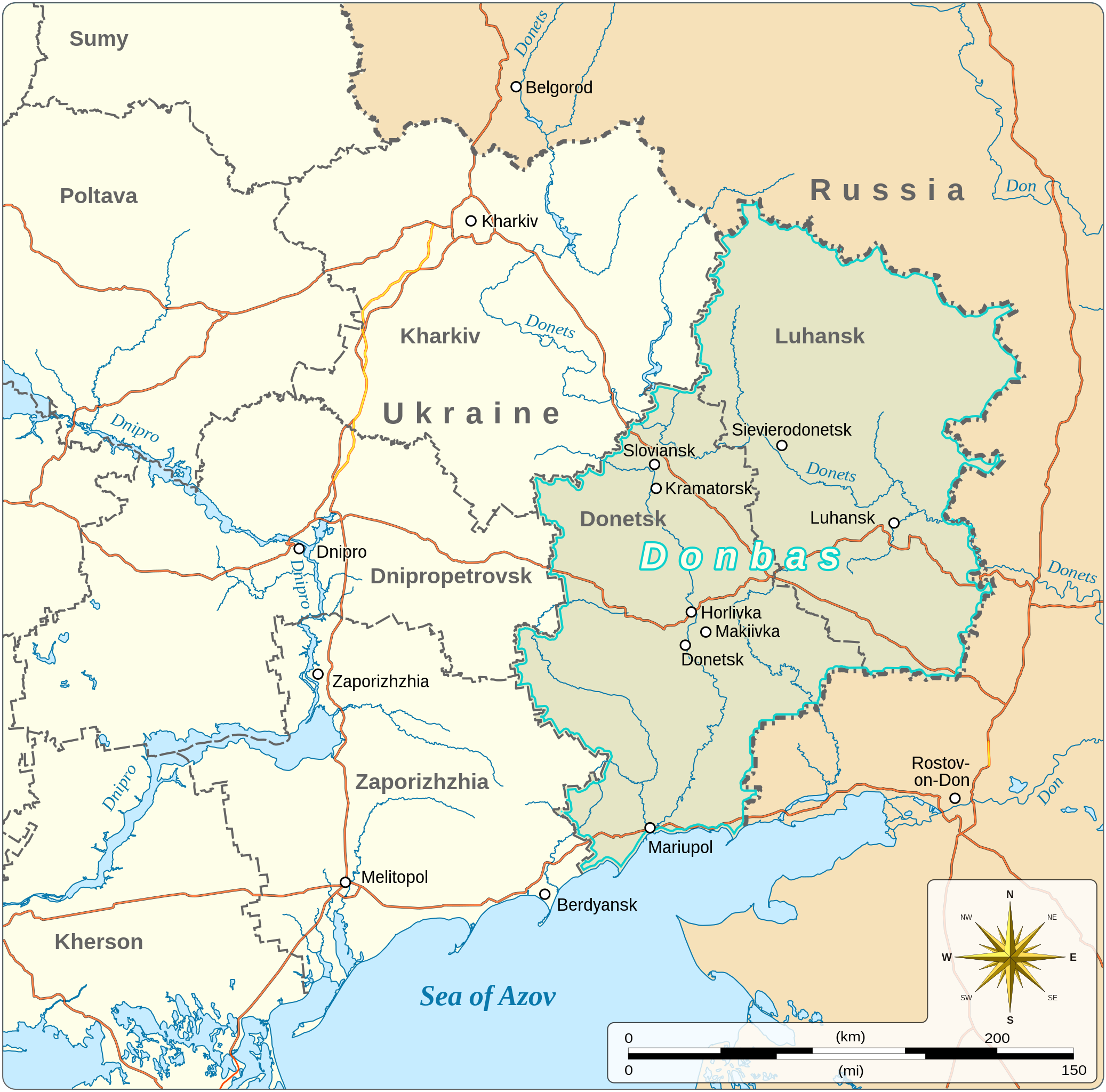
English: Map of the Donbas region of Ukraine
|
|||||||||||||||||||||||||||||||||||||
| ວັນທີ | ||||||||||||||||||||||||||||||||||||||
| Source |
Own work based on:
|
|||||||||||||||||||||||||||||||||||||
| ຜູ້ຂຽນ | Goran_tek-en | |||||||||||||||||||||||||||||||||||||
| Permission (Reusing this file) |
This file is licensed under the Creative Commons Attribution-Share Alike 4.0 International license. Attribution: Goran_tek-en
|
|||||||||||||||||||||||||||||||||||||
| Other versions |
|
|||||||||||||||||||||||||||||||||||||
| SVG genesis | This vector image was created with Inkscape. |
|||||||||||||||||||||||||||||||||||||


.svg)

| Object location | | View this and other nearby images on: OpenStreetMap |
|---|


ປະຫວັດໄຟລ໌
ຄລິກທີ່ ວັນທີ/ເວລາ ເພື່ອເບິ່ງໄຟລ໌ດັ່ງທີ່ມັນປາກົດໃນເວລານັ້ນ
| ວັນເວລາ | ຮູບຍໍ່ | ມິຕິ | ຜູ້ໃຊ້ | ຄວາມເຫັນ | |
|---|---|---|---|---|---|
| ປະຈຸບັນ | 12:41, 6 ກຸມພາ 2023 | | 1,018 × 1,005(1.32 MB) | Illchy | File uploaded using svgtranslate tool (https://svgtranslate.toolforge.org/). Added translation for id. |
| 17:08, 11 ຕຸລາ 2022 |  | 1,018 × 1,005(1.32 MB) | Batouki | File uploaded using svgtranslate tool (https://svgtranslate.toolforge.org/). Added translation for fr. | |
| 19:03, 13 ມີນາ 2022 |  | 1,018 × 1,005(1.29 MB) | Goran tek-en | {{Information |description ={{en|Map of the Donbas region of Ukraine}} {{Institution |wikidata=Q16335075}} {{Institution |wikidata=Q605714}} {{Institution |wikidata=Q212}} {{Institution |wikidata=Q159}} |date =2022-03-13 |source ={{Own based|Donbas (2015–2022).svg|b1=Goran tek-en}} <br> Information from: *Requested by and knowledge from {{U|RGloucester}} |author =Goran_tek-en |permission ={{Cc-by-sa-4.0 |1= Goran_tek-en}} |other... |
ການໃຊ້ໄຟລ໌
ໜ້າຕໍ່ໄປນີ້ເຊື່ອມໂຍງຫາໄຟລ໌ນີ້:
ການໃຊ້ໄຟລ໌ທົ່ວໂລກ
ວິກິອື່ນ ໆ ຕໍ່ໄປນີ້ໃຊ້ໄຟລ໌ນີ້:
- ການໃຊ້ງານເທິງ bg.wikipedia.org
- ການໃຊ້ງານເທິງ br.wikipedia.org
- ການໃຊ້ງານເທິງ en.wikipedia.org
- ການໃຊ້ງານເທິງ fr.wikipedia.org
- ການໃຊ້ງານເທິງ gv.wikipedia.org
- ການໃຊ້ງານເທິງ is.wikipedia.org
- ການໃຊ້ງານເທິງ mg.wikipedia.org
- ການໃຊ້ງານເທິງ nl.wikipedia.org
- ການໃຊ້ງານເທິງ pt.wikipedia.org
- ການໃຊ້ງານເທິງ sl.wikipedia.org
- ການໃຊ້ງານເທິງ uz.wikipedia.org