ຮູບ:Map indianized kingdoms indochina.jpg
ຂະໜາດຂອງຕົວຢ່າງນີ້: 576 × 600 ພິກເຊວ ຄວາມລະອຽດອື່ນ ໆ: 230 × 240 ພິກເຊວ | 461 × 480 ພິກເຊວ | 963 × 1,003 ພິກເຊວ
ໄຟລ໌ຕົ້ນສະບັບ (963 × 1,003 ປິກເຊລ, ຂະໜາດໄຟລ໌: 223 KB, MIME type: image/jpeg)
ສະຫຼຸບ
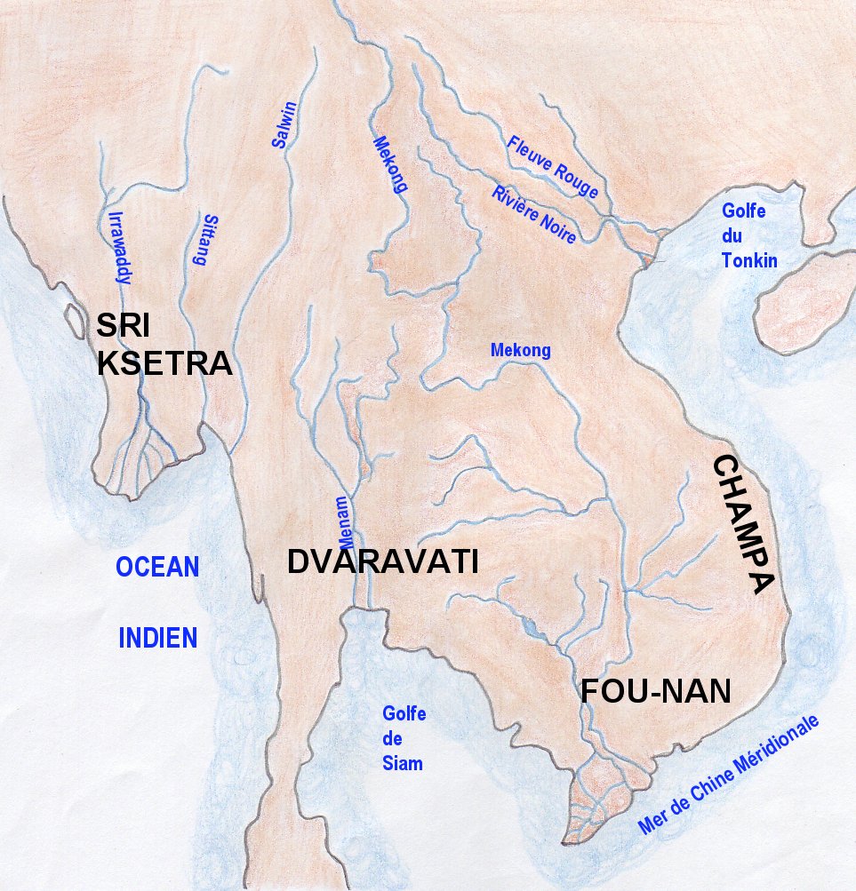
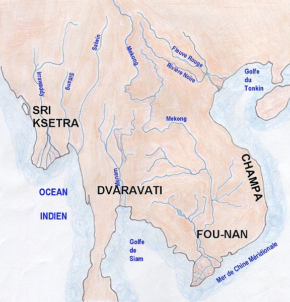
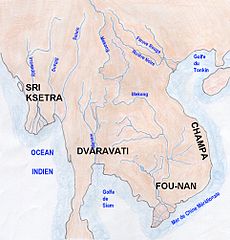
| ລາຍລະອຽດ | Map of indianized kingdoms of Indochina (1st to IXth centuries AC) |
| ວັນທີ | |
| Source | Own work |
| ຜູ້ຂຽນ | Emmanuel de Chambost (France) |
| Permission (Reusing this file) |
This map of indianized kingdoms, created by myself of Indochina is in the public domain without any restriction. EdC, June 18th 2006 |
Licensing
| I, the copyright holder of this work, release this work into the public domain. This applies worldwide. In some countries this may not be legally possible; if so: I grant anyone the right to use this work for any purpose, without any conditions, unless such conditions are required by law. |
ປະຫວັດໄຟລ໌
ຄລິກທີ່ ວັນທີ/ເວລາ ເພື່ອເບິ່ງໄຟລ໌ດັ່ງທີ່ມັນປາກົດໃນເວລານັ້ນ
| ວັນເວລາ | ຮູບຍໍ່ | ມິຕິ | ຜູ້ໃຊ້ | ຄວາມເຫັນ | |
|---|---|---|---|---|---|
| ປະຈຸບັນ | 15:11, 18 ມິຖຸນາ 2006 | | 963 × 1,003(223 KB) | EdC | == Summary == {{Information |Description= Map of indianized kingdoms of Indochina (1st to IXth centuries AC) |Source=Created by the author |Date= June 16th 2006 |Author=Emmanuel de Chambost (France) |Permission=This map of indianized kingdoms, created by |
ການໃຊ້ໄຟລ໌
ໜ້າຕໍ່ໄປນີ້ເຊື່ອມໂຍງຫາໄຟລ໌ນີ້:
ການໃຊ້ໄຟລ໌ທົ່ວໂລກ
ວິກິອື່ນ ໆ ຕໍ່ໄປນີ້ໃຊ້ໄຟລ໌ນີ້:
- ການໃຊ້ງານເທິງ en.wikipedia.org
- ການໃຊ້ງານເທິງ fi.wikibooks.org
- ການໃຊ້ງານເທິງ fr.wikipedia.org
- ການໃຊ້ງານເທິງ he.wikipedia.org
- ການໃຊ້ງານເທິງ ja.wikipedia.org