ຮູບ:LocationNorthKorea.png
ບໍ່ມີຂະໜາດລະອຽດກວ່າ
LocationNorthKorea.png (250 × 115 ປິກເຊລ, ຂະໜາດໄຟລ໌: 6 KB, MIME type: image/png)

|
File:Locator map of North Korea.svg is a vector version of this file. It should be used in place of this PNG file when not inferior.
File:LocationNorthKorea.png → File:Locator map of North Korea.svg
For more information, see Help:SVG. |
 |
|
|
File:LocationNorthKorea.svg is a vector version of this file. It should be used in place of this PNG file when not inferior.
File:LocationNorthKorea.png → File:LocationNorthKorea.svg
For more information, see Help:SVG. |
 |
ສະຫຼຸບ
| ລາຍລະອຽດ | |
| Source | English Wikipedia |
| ຜູ້ຂຽນ | Vardion |
| Other versions |
|
Licensing
| |
This work has been released into the public domain by its author, Vardion, at the ອັງກິດ ວິກິພີເດຍ project. This applies worldwide. In case this is not legally possible: |
ປະຫວັດໄຟລ໌
ຄລິກທີ່ ວັນທີ/ເວລາ ເພື່ອເບິ່ງໄຟລ໌ດັ່ງທີ່ມັນປາກົດໃນເວລານັ້ນ
| ວັນເວລາ | ຮູບຍໍ່ | ມິຕິ | ຜູ້ໃຊ້ | ຄວາມເຫັນ | |
|---|---|---|---|---|---|
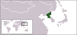
| ປະຈຸບັນ | 02:58, 23 ທັນວາ 2004 | | 250 × 115(6 KB) | EugeneZelenko | Location map for the North Korea.<br/>Originally created for English Wikipedia by Vardion.<br/>{{PD}}<br/>Category:Country locator maps |
ການໃຊ້ໄຟລ໌
ບໍ່ມີໜ້າໃດ ລິ້ງຄ໌ ຫາ ໄຟລ໌ນີ້.
ການໃຊ້ໄຟລ໌ທົ່ວໂລກ
ວິກິອື່ນ ໆ ຕໍ່ໄປນີ້ໃຊ້ໄຟລ໌ນີ້:
- ການໃຊ້ງານເທິງ ar.wikinews.org
- الرئيس الأمريكي الأسبق بيل كلينتون يلتقي رئيس كوريا الشمالية
- قالب:كوريا الشمالية
- كوريا الشمالية تنوي إطلاق قمر صناعي في هذا الشهر
- كوريا الديمقراطية تعلن إلغاء اتفاقية عدم الاعتداء مع كوريا الجنوبية
- بعد زوج عمته "كيم جونغ أون" يعدم وزير الدفاع
- كوريا الشمالية تتحدى أميركا بصاروخ "مجهول الطراز"
- كوريا الشمالية: واشنطن تدفعنا لحرب نووية
- دلائل على تورط كوريا الشمالية في هجوم "الفدية"
- كوريا الشمالية تؤكد نجاح تجربتها الصاروخية الأخيرة
- كوريا الشمالية تطلق مجموعة من الصواريخ التجريبية
- كوريا الشمالية تعلن نجاح إطلاق صاروخ عابر للقارات
- كوريا الشمالية تضع خطة لضرب غوام الأمريكية
- ري يونج: ترمب أشعل فتيل الحرب
- كوريا الشمالية تعلن أنها أصبحت دولة نووية
- كيم: زر القنبلة النووية موجود على مكتبي دائماً
- محادثات بين الكوريتين الأولى من نوعها منذ عامين
- 70 مليون إنسان يعانون من أزمات بصمت
- عقلية انتحارية: عن الحرب المرتقَبة في شمال شرق آسيا
- ການໃຊ້ງານເທິງ ast.wikipedia.org
- ການໃຊ້ງານເທິງ bg.wikipedia.org
- ການໃຊ້ງານເທິງ bn.wikipedia.org
- ການໃຊ້ງານເທິງ bo.wikipedia.org
- ການໃຊ້ງານເທິງ bpy.wikipedia.org
- ການໃຊ້ງານເທິງ br.wikipedia.org
- ການໃຊ້ງານເທິງ bs.wikipedia.org
- ການໃຊ້ງານເທິງ cbk-zam.wikipedia.org
- ການໃຊ້ງານເທິງ csb.wikipedia.org
- ການໃຊ້ງານເທິງ de.wikinews.org
- ການໃຊ້ງານເທິງ de.wikivoyage.org
- ການໃຊ້ງານເທິງ de.wiktionary.org
- ການໃຊ້ງານເທິງ dsb.wikipedia.org
- ການໃຊ້ງານເທິງ dz.wikipedia.org
- ການໃຊ້ງານເທິງ el.wiktionary.org
- ການໃຊ້ງານເທິງ en.wikipedia.org
- ການໃຊ້ງານເທິງ en.wikinews.org
- ການໃຊ້ງານເທິງ en.wikivoyage.org
- ການໃຊ້ງານເທິງ en.wiktionary.org
- ການໃຊ້ງານເທິງ eu.wiktionary.org
- ການໃຊ້ງານເທິງ fi.wikinews.org
- ການໃຊ້ງານເທິງ frp.wikipedia.org
View more global usage of this file.