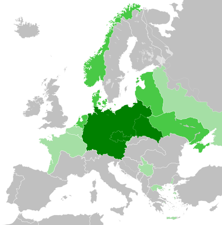
ຮູບ:Greater German Reich (1942).svg

Size of this PNG preview of this SVG file: 450 × 456 ພິກເຊວ. ຄວາມລະອຽດອື່ນ ໆ: 237 × 240 ພິກເຊວ | 474 × 480 ພິກເຊວ | 758 × 768 ພິກເຊວ | 1,011 × 1,024 ພິກເຊວ | 2,021 × 2,048 ພິກເຊວ
ໄຟລ໌ຕົ້ນສະບັບ (SVG file, nominally 450 × 456 pixels, file size: 594 KB)


.svg)
.svg)
.svg)
.svg)
.svg)


.svg)
.svg)
.svg)


.png)
.png)


.svg)


.svg)

.svg)


.svg)
.svg)
.svg)
.svg)


.svg)
.png)


.svg)


.svg)
.svg)


.svg)


.svg)


.svg)
.svg)
.svg)
.svg)
.svg)
.svg)
.svg)
.svg)
_cropped.svg)
.svg)
.svg)
.svg)
.svg)
.svg)
.svg)
.svg)
.svg)
.svg)
.svg)
.svg)
.svg)
.svg)
.svg)
.svg)
.svg)
.svg)
.svg)
.svg)
.svg)
.svg)
.svg)
.svg)
.svg)
.svg)
.svg)
.svg)
.svg)
.svg)
.svg)
.svg)
.svg)
.svg)
.svg)
.svg)
.svg)
.svg)
.svg)
.svg)
.svg)
.svg)
.svg)
.svg)
.svg)
.svg)
ປະຫວັດໄຟລ໌
ຄລິກທີ່ ວັນທີ/ເວລາ ເພື່ອເບິ່ງໄຟລ໌ດັ່ງທີ່ມັນປາກົດໃນເວລານັ້ນ
.svg&dir=prev)
.svg&offset=20180422235102)
.svg&offset=&limit=20)
.svg&offset=&limit=50)
.svg&offset=&limit=100)
.svg&offset=&limit=250)
.svg&offset=&limit=500)
| ວັນເວລາ | ຮູບຍໍ່ | ມິຕິ | ຜູ້ໃຊ້ | ຄວາມເຫັນ | |
|---|---|---|---|---|---|
| ປະຈຸບັນ | 20:48, 20 ມີນາ 2023 | | 450 × 456(594 KB) | Qbox673 | Reverted to version as of 07:51, 23 August 2020 (UTC) Please establish consensus on the talk page before changing. |
| 19:16, 19 ມີນາ 2023 |  | 450 × 456(1.51 MB) | Daniilnihuya | Reverted to version as of 18:47, 22 August 2020 (UTC) | |
| 07:51, 23 ສິງຫາ 2020 |  | 450 × 456(594 KB) | BOS2077 | Reverted to version as of 13:23, 28 July 2020 (UTC) | |
| 18:47, 22 ສິງຫາ 2020 |  | 450 × 456(1.51 MB) | Terryfirut | Reverted to version as of 17:17, 5 July 2020 (UTC) | |
| 13:23, 28 ກໍລະກົດ 2020 |  | 450 × 456(594 KB) | Staberinde | Reverted to version as of 01:04, 24 April 2018 (UTC) restore old version, puppet states are not the same thing as occupied territory | |
| 04:12, 7 ກໍລະກົດ 2020 |  | 450 × 456(1.04 MB) | Croatianpotato | Reverted to version as of 22:35, 4 July 2020 (UTC) | |
| 17:17, 5 ກໍລະກົດ 2020 |  | 450 × 456(1.51 MB) | Hell - lllio | Winter Offensive Occupied Territory | |
| 22:35, 4 ກໍລະກົດ 2020 |  | 450 × 456(1.04 MB) | Hell - lllio | Vichy France (and its colonies) and Slovakia we're German Puppet States, so it should be Included in the Civilian Controlled Occupied Territories (Puppets) | |
| 01:04, 24 ເມສາ 2018 |  | 450 × 456(594 KB) | TRAJAN 117 | +++ | |
| 23:51, 22 ເມສາ 2018 |  | 450 × 456(594 KB) | TRAJAN 117 | +++ |
ການໃຊ້ໄຟລ໌
ໜ້າຕໍ່ໄປນີ້ເຊື່ອມໂຍງຫາໄຟລ໌ນີ້:
ການໃຊ້ໄຟລ໌ທົ່ວໂລກ
ວິກິອື່ນ ໆ ຕໍ່ໄປນີ້ໃຊ້ໄຟລ໌ນີ້:
- ການໃຊ້ງານເທິງ ar.wikipedia.org
- ການໃຊ້ງານເທິງ av.wikipedia.org
- ການໃຊ້ງານເທິງ az.wikipedia.org
- ການໃຊ້ງານເທິງ bbc.wikipedia.org
- ການໃຊ້ງານເທິງ bg.wikipedia.org
- ການໃຊ້ງານເທິງ cs.wikipedia.org
- ການໃຊ້ງານເທິງ el.wikipedia.org
- ການໃຊ້ງານເທິງ en.wikipedia.org
- ການໃຊ້ງານເທິງ es.wikipedia.org
- ການໃຊ້ງານເທິງ fr.wikipedia.org
- ການໃຊ້ງານເທິງ gn.wikipedia.org
- ການໃຊ້ງານເທິງ he.wikipedia.org
- ການໃຊ້ງານເທິງ hr.wikipedia.org
- ການໃຊ້ງານເທິງ hu.wikipedia.org
- ການໃຊ້ງານເທິງ id.wikipedia.org
- Jerman Nazi
- Daftar imperium terbesar
- Anschluss
- Wikipedia:Artikel pilihan/Jadwal/Usulan/2020
- Wikipedia:Artikel pilihan/Jadwal/Usulan/2020/Periode 3
- Wikipedia:Artikel pilihan/Jadwal/Usulan/2020/Periode 8
- Wikipedia:Artikel pilihan/Daftar artikel pilihan 2020
- Wikipedia:Artikel Pilihan/32 2020
- Wikipedia:Arsip halaman utama/2020/08/03
- Wikipedia:Arsip halaman utama/2020/08/04
- Wikipedia:Arsip halaman utama/2020/08/05
- Wikipedia:Arsip halaman utama/2020/08/06
- Wikipedia:Arsip halaman utama/2020/08/07
- Wikipedia:Arsip halaman utama/2020/08/08
- Wikipedia:Arsip halaman utama/2020/08/09
- Wikipedia:Artikel pilihan/Daftar artikel pilihan 2023
- Wikipedia:Artikel pilihan/Jadwal/Usulan/2023
View more global usage of this file.
.svg)
.svg)