ຮູບ:Cambodia Cold War (orthographic projection).svg

Size of this PNG preview of this SVG file: 550 × 551 ພິກເຊວ. ຄວາມລະອຽດອື່ນ ໆ: 240 × 240 ພິກເຊວ | 479 × 480 ພິກເຊວ | 767 × 768 ພິກເຊວ | 1,022 × 1,024 ພິກເຊວ | 2,044 × 2,048 ພິກເຊວ
ໄຟລ໌ຕົ້ນສະບັບ (SVG file, nominally 550 × 551 pixels, file size: 290 KB)
.svg)
ສະຫຼຸບ
| ລາຍລະອຽດ |
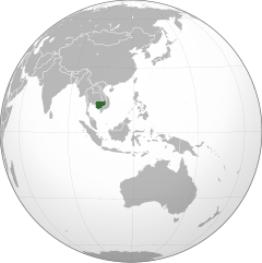
English: Orthographic map of Cambodia (Kampuchea) during the Cold War. |
| ວັນທີ | |
| Source | |
| ຜູ້ຂຽນ |
|
.svg)
| This is a retouched picture, which means that it has been digitally altered from its original version. The original can be viewed here: Southeast Asia (orthographic projection).svg:
|
Licensing
This file is licensed under the Creative Commons Attribution-Share Alike 3.0 Unported license.
- You are free:
- to share – to copy, distribute and transmit the work
- to remix – to adapt the work
- Under the following conditions:
- ສະແດງທີ່ມາ – You must give appropriate credit, provide a link to the license, and indicate if changes were made. You may do so in any reasonable manner, but not in any way that suggests the licensor endorses you or your use.
- ແບ່ງປັນຄືກັນ – If you remix, transform, or build upon the material, you must distribute your contributions under the same or compatible license as the original.
ປະຫວັດໄຟລ໌
ຄລິກທີ່ ວັນທີ/ເວລາ ເພື່ອເບິ່ງໄຟລ໌ດັ່ງທີ່ມັນປາກົດໃນເວລານັ້ນ
| ວັນເວລາ | ຮູບຍໍ່ | ມິຕິ | ຜູ້ໃຊ້ | ຄວາມເຫັນ | |
|---|---|---|---|---|---|
| ປະຈຸບັນ | 23:00, 25 ເມສາ 2012 | | 550 × 551(290 KB) | StalwartUK |
ການໃຊ້ໄຟລ໌
2 ໜ້າຕໍ່ໄປນີ້ເຊື່ອມໂຍງຫາໄຟລ໌ນີ້:
ການໃຊ້ໄຟລ໌ທົ່ວໂລກ
ວິກິອື່ນ ໆ ຕໍ່ໄປນີ້ໃຊ້ໄຟລ໌ນີ້:
- ການໃຊ້ງານເທິງ ar.wikipedia.org
- ການໃຊ້ງານເທິງ azb.wikipedia.org
- ການໃຊ້ງານເທິງ az.wikipedia.org
- ການໃຊ້ງານເທິງ be.wikipedia.org
- ການໃຊ້ງານເທິງ bg.wikipedia.org
- ການໃຊ້ງານເທິງ ceb.wikipedia.org
- ການໃຊ້ງານເທິງ chr.wikipedia.org
- ການໃຊ້ງານເທິງ cs.wikipedia.org
- ການໃຊ້ງານເທິງ da.wikipedia.org
- ການໃຊ້ງານເທິງ en.wikipedia.org
- ການໃຊ້ງານເທິງ eo.wikipedia.org
- ການໃຊ້ງານເທິງ eo.wiktionary.org
- ການໃຊ້ງານເທິງ es.wikipedia.org
- ການໃຊ້ງານເທິງ eu.wikipedia.org
- ການໃຊ້ງານເທິງ fa.wikipedia.org
- ການໃຊ້ງານເທິງ fi.wikipedia.org
- ການໃຊ້ງານເທິງ hu.wikipedia.org
- ການໃຊ້ງານເທິງ hy.wikipedia.org
- ການໃຊ້ງານເທິງ id.wikipedia.org
View more global usage of this file.
.svg)
.svg)