ຮູບ:Salginatobelbruecke suedost unten.jpg

ຂະໜາດຂອງຕົວຢ່າງນີ້: 800 × 533 ພິກເຊວ ຄວາມລະອຽດອື່ນ ໆ: 320 × 213 ພິກເຊວ | 640 × 427 ພິກເຊວ | 1,024 × 683 ພິກເຊວ | 1,280 × 853 ພິກເຊວ | 2,560 × 1,706 ພິກເຊວ | 3,521 × 2,347 ພິກເຊວ
ໄຟລ໌ຕົ້ນສະບັບ (3,521 × 2,347 ປິກເຊລ, ຂະໜາດໄຟລ໌: 6.35 MB, MIME type: image/jpeg)
| Camera location | | View this and other nearby images on: OpenStreetMap |
|---|
| ລາຍລະອຽດ |
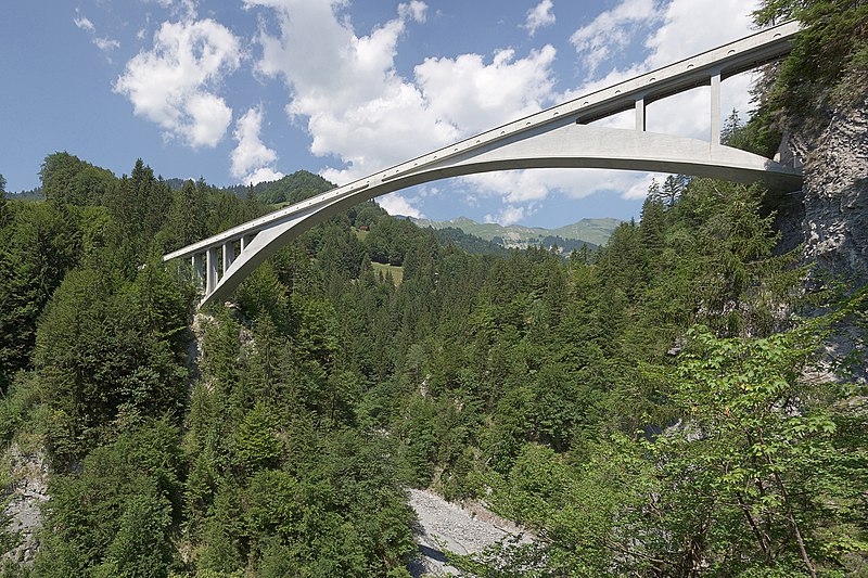
Deutsch: Die Salginatobelbrücke bei Schiers, Schweiz, Ansicht von Südosten Panorama erstellt aus vier Einzelbildern im RAW-Format bei einem Blickwinkel von 67°x48°, manuelle Bearbeitung des Ortes der Bildübergänge. English: Salginatobel Bridge near Schiers, Switzerland. View from southeast.
Français : Pont de Salginatobel près de Schiers en Suisse. Vue de sud-est. |
| ວັນທີ | |
| Source | Self-photographed |
| ຜູ້ຂຽນ | Ikiwaner |

|
Permission is granted to copy, distribute and/or modify this document under the terms of the GNU Free Documentation License, Version 1.2 or any later version published by the Free Software Foundation; with no Invariant Sections, no Front-Cover Texts, and no Back-Cover Texts. A copy of the license is included in the section entitled GNU Free Documentation License. |
| This file is licensed under the Creative Commons Attribution-Share Alike 3.0 Unported license. | ||
| ||
| This licensing tag was added to this file as part of the GFDL licensing update. |
This image has been assessed using the Quality image guidelines and is considered a Quality image.
|
ປະຫວັດໄຟລ໌
ຄລິກທີ່ ວັນທີ/ເວລາ ເພື່ອເບິ່ງໄຟລ໌ດັ່ງທີ່ມັນປາກົດໃນເວລານັ້ນ
| ວັນເວລາ | ຮູບຍໍ່ | ມິຕິ | ຜູ້ໃຊ້ | ຄວາມເຫັນ | |
|---|---|---|---|---|---|
| ປະຈຸບັນ | 21:54, 17 ກຸມພາ 2008 | | 3,521 × 2,347(6.35 MB) | Ikiwaner | |
| 14:34, 26 ກໍລະກົດ 2006 |  | 3,521 × 2,347(4.76 MB) | Ikiwaner | Die Salginatobelbrücke bei Schiers, Schweiz Ansicht von Südosten Panorama erstellt aus vier Einzelbildern im RAW-Format bei einem Blickwinkel von 67°x48°, manuelle Bearbeitung des Ortes der Bildübergänge. Eigenes Bild vom 25. Juli 2006 {{GFDL}} |
ການໃຊ້ໄຟລ໌
ໜ້າຕໍ່ໄປນີ້ເຊື່ອມໂຍງຫາໄຟລ໌ນີ້:
ການໃຊ້ໄຟລ໌ທົ່ວໂລກ
ວິກິອື່ນ ໆ ຕໍ່ໄປນີ້ໃຊ້ໄຟລ໌ນີ້:
- ການໃຊ້ງານເທິງ ast.wikipedia.org
- ການໃຊ້ງານເທິງ en.wikipedia.org
- ການໃຊ້ງານເທິງ es.wikipedia.org
- ການໃຊ້ງານເທິງ fr.wikipedia.org
- ການໃຊ້ງານເທິງ ja.wikipedia.org
- ການໃຊ້ງານເທິງ lt.wikipedia.org
- ການໃຊ້ງານເທິງ my.wikipedia.org
- ການໃຊ້ງານເທິງ ru.wikipedia.org
- ການໃຊ້ງານເທິງ vi.wikipedia.org