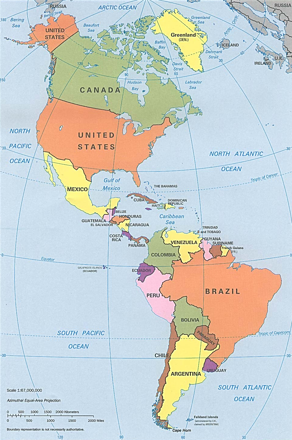
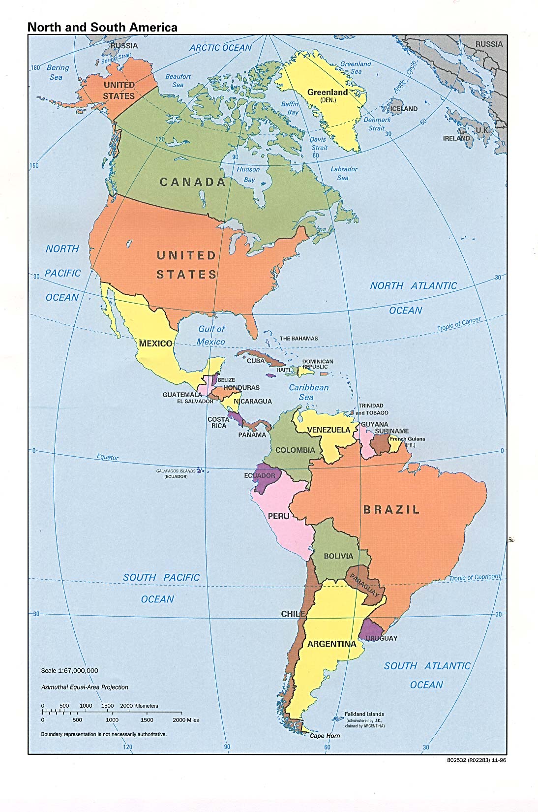
ຮູບ:N&SAmerica-pol.jpg
ຂະໜາດຂອງຕົວຢ່າງນີ້: 397 × 599 ພິກເຊວ ຄວາມລະອຽດອື່ນ ໆ: 159 × 240 ພິກເຊວ | 318 × 480 ພິກເຊວ | 964 × 1,455 ພິກເຊວ
ໄຟລ໌ຕົ້ນສະບັບ (964 × 1,455 ປິກເຊລ, ຂະໜາດໄຟລ໌: 1.32 MB, MIME type: image/jpeg)
ສະຫຼຸບ
| ລາຍລະອຽດ | Americas with political boundaries |
| ວັນທີ | |
| Source | http://www.lib.utexas.edu/maps/americas/americas_pol96.jpg |
| ຜູ້ຂຽນ | CIA, original political map from Perry-Castañeda Library Map Collection; University of Texas Library Online |
Licensing
| This image is a work of a Central Intelligence Agency employee, taken or made as part of that person's official duties. As a Work of the United States Government, this image or media is in the public domain in the United States.
|

|
ປະຫວັດໄຟລ໌
ຄລິກທີ່ ວັນທີ/ເວລາ ເພື່ອເບິ່ງໄຟລ໌ດັ່ງທີ່ມັນປາກົດໃນເວລານັ້ນ
| ວັນເວລາ | ຮູບຍໍ່ | ມິຕິ | ຜູ້ໃຊ້ | ຄວາມເຫັນ | |
|---|---|---|---|---|---|
| ປະຈຸບັນ | 09:26, 22 ມັງກອນ 2023 | | 964 × 1,455(1.32 MB) | Lojwe | Cropped 1 % horizontally, < 1 % vertically using CropTool with precise mode. |
| 16:51, 12 ກໍລະກົດ 2012 |  | 970 × 1,460(1.29 MB) | McZusatz | cropped (used source file) | |
| 20:38, 10 ມັງກອນ 2010 |  | 1,000 × 1,521(286 KB) | Entheta | cropped | |
| 18:32, 25 ມີນາ 2007 |  | 1,094 × 1,650(289 KB) | Corticopious | North and South America: political map (CIA) |
ການໃຊ້ໄຟລ໌
ໜ້າຕໍ່ໄປນີ້ເຊື່ອມໂຍງຫາໄຟລ໌ນີ້:
ການໃຊ້ໄຟລ໌ທົ່ວໂລກ
ວິກິອື່ນ ໆ ຕໍ່ໄປນີ້ໃຊ້ໄຟລ໌ນີ້:
- ການໃຊ້ງານເທິງ an.wikipedia.org
- ການໃຊ້ງານເທິງ ar.wikipedia.org
- ການໃຊ້ງານເທິງ as.wikipedia.org
- ການໃຊ້ງານເທິງ az.wikipedia.org
- ການໃຊ້ງານເທິງ az.wiktionary.org
- ການໃຊ້ງານເທິງ ba.wikipedia.org
- ການໃຊ້ງານເທິງ ceb.wikipedia.org
- ການໃຊ້ງານເທິງ el.wikipedia.org
- ການໃຊ້ງານເທິງ en.wikipedia.org
- ການໃຊ້ງານເທິງ es.wikipedia.org
- ການໃຊ້ງານເທິງ es.wikiversity.org
- ການໃຊ້ງານເທິງ fa.wikipedia.org
- ການໃຊ້ງານເທິງ fi.wikipedia.org
- ການໃຊ້ງານເທິງ fr.wikipedia.org
- ການໃຊ້ງານເທິງ fr.wiktionary.org
- ການໃຊ້ງານເທິງ fy.wikipedia.org
- ການໃຊ້ງານເທິງ he.wikipedia.org
- ການໃຊ້ງານເທິງ hi.wikipedia.org
- ການໃຊ້ງານເທິງ hy.wikipedia.org
- ການໃຊ້ງານເທິງ id.wikipedia.org
- ການໃຊ້ງານເທິງ ig.wikipedia.org
- ການໃຊ້ງານເທິງ ik.wikipedia.org
- ການໃຊ້ງານເທິງ inh.wikipedia.org
- ການໃຊ້ງານເທິງ it.wikipedia.org
- ການໃຊ້ງານເທິງ ka.wikipedia.org
- ການໃຊ້ງານເທິງ kcg.wikipedia.org
- ການໃຊ້ງານເທິງ kk.wikipedia.org
- ການໃຊ້ງານເທິງ km.wikipedia.org
- ການໃຊ້ງານເທິງ kn.wikipedia.org
- ການໃຊ້ງານເທິງ ko.wikipedia.org
- ການໃຊ້ງານເທິງ la.wikipedia.org
- ການໃຊ້ງານເທິງ mk.wikipedia.org
- ການໃຊ້ງານເທິງ ml.wikipedia.org
- ການໃຊ້ງານເທິງ mn.wikipedia.org
- ການໃຊ້ງານເທິງ mr.wikipedia.org
- ການໃຊ້ງານເທິງ nds-nl.wikipedia.org
- ການໃຊ້ງານເທິງ nl.wikipedia.org
- ການໃຊ້ງານເທິງ no.wikipedia.org
- ການໃຊ້ງານເທິງ pcd.wikipedia.org
- ການໃຊ້ງານເທິງ pt.wikipedia.org
- ການໃຊ້ງານເທິງ ru.wikipedia.org
View more global usage of this file.