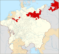
ຮູບ:Locator Brandenburg-Prussia within the Holy Roman Empire (1618).svg

Size of this PNG preview of this SVG file: 658 × 600 ພິກເຊວ. ຄວາມລະອຽດອື່ນ ໆ: 263 × 240 ພິກເຊວ | 527 × 480 ພິກເຊວ | 843 × 768 ພິກເຊວ | 1,123 × 1,024 ພິກເຊວ | 2,247 × 2,048 ພິກເຊວ | 2,769 × 2,524 ພິກເຊວ
ໄຟລ໌ຕົ້ນສະບັບ (SVG file, nominally 2,769 × 2,524 pixels, file size: 1,024 KB)
ປະຫວັດໄຟລ໌
ຄລິກທີ່ ວັນທີ/ເວລາ ເພື່ອເບິ່ງໄຟລ໌ດັ່ງທີ່ມັນປາກົດໃນເວລານັ້ນ
| ວັນເວລາ | ຮູບຍໍ່ | ມິຕິ | ຜູ້ໃຊ້ | ຄວາມເຫັນ | |
|---|---|---|---|---|---|
| ປະຈຸບັນ | 00:50, 28 ມັງກອນ 2015 |  | 2,769 × 2,524(1,024 KB) | Sir Iain | Corrected Bohemian border |
| 14:20, 27 ມັງກອນ 2015 |  | 2,769 × 2,524(1,014 KB) | Sir Iain | Redone Schleswig-Holstein | |
| 00:55, 5 ມັງກອນ 2015 |  | 2,769 × 2,524(994 KB) | Sir Iain | Savoy shown as core territory of the HRR | |
| 20:28, 23 ທັນວາ 2014 |  | 2,769 × 2,524(994 KB) | Sir Iain | Removed the Imperial border between Germany and the Netherlands | |
| 14:56, 22 ທັນວາ 2014 |  | 2,769 × 2,524(999 KB) | Sir Iain | User created page with UploadWizard |
ການໃຊ້ໄຟລ໌
ໜ້າຕໍ່ໄປນີ້ເຊື່ອມໂຍງຫາໄຟລ໌ນີ້:
ການໃຊ້ໄຟລ໌ທົ່ວໂລກ
ວິກິອື່ນ ໆ ຕໍ່ໄປນີ້ໃຊ້ໄຟລ໌ນີ້:
- ການໃຊ້ງານເທິງ azb.wikipedia.org
- ການໃຊ້ງານເທິງ bg.wikipedia.org
- ການໃຊ້ງານເທິງ bxr.wikipedia.org
- ການໃຊ້ງານເທິງ cs.wikipedia.org
- ການໃຊ້ງານເທິງ de.wikipedia.org
- ການໃຊ້ງານເທິງ en.wikipedia.org
- ການໃຊ້ງານເທິງ en.wikibooks.org
- ການໃຊ້ງານເທິງ eo.wikipedia.org
- ການໃຊ້ງານເທິງ es.wikipedia.org
- ການໃຊ້ງານເທິງ fi.wikipedia.org
- ການໃຊ້ງານເທິງ fr.wikipedia.org
- ການໃຊ້ງານເທິງ he.wikipedia.org
- ການໃຊ້ງານເທິງ id.wikipedia.org
- ການໃຊ້ງານເທິງ it.wikipedia.org
- ການໃຊ້ງານເທິງ ja.wikipedia.org
- ການໃຊ້ງານເທິງ ko.wikipedia.org
- ການໃຊ້ງານເທິງ lv.wikipedia.org
- ການໃຊ້ງານເທິງ pl.wikipedia.org
- ການໃຊ້ງານເທິງ ru.wikipedia.org
- ການໃຊ້ງານເທິງ ru.wikiversity.org
- ການໃຊ້ງານເທິງ th.wikipedia.org
- ການໃຊ້ງານເທິງ tr.wikipedia.org
- ການໃຊ້ງານເທິງ ur.wikipedia.org
- ການໃຊ້ງານເທິງ vi.wikipedia.org
- ການໃຊ້ງານເທິງ vls.wikipedia.org
- ການໃຊ້ງານເທິງ zh.wikipedia.org