ຮູບ:Livigno&LagoDelGallo.JPG

ຂະໜາດຂອງຕົວຢ່າງນີ້: 800 × 600 ພິກເຊວ ຄວາມລະອຽດອື່ນ ໆ: 320 × 240 ພິກເຊວ | 640 × 480 ພິກເຊວ | 1,024 × 768 ພິກເຊວ | 1,280 × 960 ພິກເຊວ | 2,048 × 1,536 ພິກເຊວ
ໄຟລ໌ຕົ້ນສະບັບ (2,048 × 1,536 ປິກເຊລ, ຂະໜາດໄຟລ໌: 620 KB, MIME type: image/jpeg)
ສະຫຼຸບ
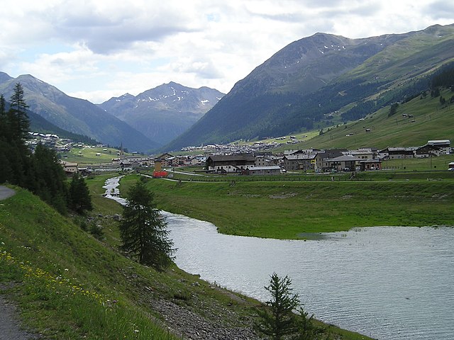
Italiano: Livigno ripresa in lontananza dalla confluenza della Spöl nel Lago del Gallo
- Position: +46° 33' 20.11", +10° 8' 51.25", view: SSW
| Camera location | | View this and other nearby images on: OpenStreetMap |
|---|
Licensing
| I, the copyright holder of this work, release this work into the public domain. This applies worldwide. In some countries this may not be legally possible; if so: I grant anyone the right to use this work for any purpose, without any conditions, unless such conditions are required by law. |
| Annotations | This image is annotated: View the annotations at Commons |
ປະຫວັດໄຟລ໌
ຄລິກທີ່ ວັນທີ/ເວລາ ເພື່ອເບິ່ງໄຟລ໌ດັ່ງທີ່ມັນປາກົດໃນເວລານັ້ນ
| ວັນເວລາ | ຮູບຍໍ່ | ມິຕິ | ຜູ້ໃຊ້ | ຄວາມເຫັນ | |
|---|---|---|---|---|---|
| ປະຈຸບັນ | 16:15, 17 ກໍລະກົດ 2006 | | 2,048 × 1,536(620 KB) | Massimo Macconi | Livigno ripresa in lontananza dalle rive del Lago del Gallo |
ການໃຊ້ໄຟລ໌
ໜ້າຕໍ່ໄປນີ້ເຊື່ອມໂຍງຫາໄຟລ໌ນີ້:
ການໃຊ້ໄຟລ໌ທົ່ວໂລກ
ວິກິອື່ນ ໆ ຕໍ່ໄປນີ້ໃຊ້ໄຟລ໌ນີ້:
- ການໃຊ້ງານເທິງ arz.wikipedia.org
- ການໃຊ້ງານເທິງ azb.wikipedia.org
- ການໃຊ້ງານເທິງ ceb.wikipedia.org
- ການໃຊ້ງານເທິງ cv.wikipedia.org
- ການໃຊ້ງານເທິງ de.wikipedia.org
- ການໃຊ້ງານເທິງ en.wikipedia.org
- ການໃຊ້ງານເທິງ es.wikipedia.org
- ການໃຊ້ງານເທິງ fi.wikipedia.org
- ການໃຊ້ງານເທິງ fr.wikipedia.org
- ການໃຊ້ງານເທິງ hr.wikipedia.org
- ການໃຊ້ງານເທິງ it.wikipedia.org
- ການໃຊ້ງານເທິງ lmo.wikipedia.org
- ການໃຊ້ງານເທິງ mk.wikipedia.org
- ການໃຊ້ງານເທິງ mt.wikipedia.org
- ການໃຊ້ງານເທິງ nl.wikipedia.org
- ການໃຊ້ງານເທິງ nn.wikipedia.org
- ການໃຊ້ງານເທິງ oc.wikipedia.org
- ການໃຊ້ງານເທິງ ru.wikipedia.org
- ການໃຊ້ງານເທິງ sr.wikipedia.org
- ການໃຊ້ງານເທິງ sv.wikipedia.org
- ການໃຊ້ງານເທິງ www.wikidata.org
- ການໃຊ້ງານເທິງ zh.wikipedia.org