ຮູບ:Indian Ocean-CIA WFB Map.png
ບໍ່ມີຂະໜາດລະອຽດກວ່າ
Indian_Ocean-CIA_WFB_Map.png (330 × 330 ປິກເຊລ, ຂະໜາດໄຟລ໌: 11 KB, MIME type: image/png)

|
This locator map image could be re-created using vector graphics as an SVG file. This has several advantages; see Commons:Media for cleanup for more information. If an SVG form of this image is available, please upload it and afterwards replace this template with
{{vector version available|new image name}}.
It is recommended to name the SVG file “Indian Ocean-CIA WFB Map.svg”—then the template Vector version available (or Vva) does not need the new image name parameter. |
ສະຫຼຸບ
| ລາຍລະອຽດ |
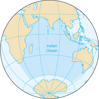
English: Map of The Indian Ocean with English captions. |
|||
| ວັນທີ | ||||
| Source | The World Factbook | |||
| ຜູ້ຂຽນ | United States Central Intelligence Agency | |||
| Permission (Reusing this file) |
|
|||
| Other versions |
|


Derivative works
Derivative works of this file: Samudra Hindia.png
ປະຫວັດໄຟລ໌
ຄລິກທີ່ ວັນທີ/ເວລາ ເພື່ອເບິ່ງໄຟລ໌ດັ່ງທີ່ມັນປາກົດໃນເວລານັ້ນ
| ວັນເວລາ | ຮູບຍໍ່ | ມິຕິ | ຜູ້ໃຊ້ | ຄວາມເຫັນ | |
|---|---|---|---|---|---|
| ປະຈຸບັນ | 09:14, 27 ມີນາ 2005 | | 330 × 330(11 KB) | Wolfman~commonswiki | {{CIA-map}} |
ການໃຊ້ໄຟລ໌
ໜ້າຕໍ່ໄປນີ້ເຊື່ອມໂຍງຫາໄຟລ໌ນີ້:
ການໃຊ້ໄຟລ໌ທົ່ວໂລກ
ວິກິອື່ນ ໆ ຕໍ່ໄປນີ້ໃຊ້ໄຟລ໌ນີ້:
- ການໃຊ້ງານເທິງ am.wikipedia.org
- ການໃຊ້ງານເທິງ ang.wikipedia.org
- ການໃຊ້ງານເທິງ anp.wikipedia.org
- ການໃຊ້ງານເທິງ as.wikipedia.org
- ການໃຊ້ງານເທິງ azb.wikipedia.org
- ການໃຊ້ງານເທິງ ba.wikipedia.org
- ການໃຊ້ງານເທິງ be.wikipedia.org
- ການໃຊ້ງານເທິງ bg.wikipedia.org
- ການໃຊ້ງານເທິງ bh.wikipedia.org
- ການໃຊ້ງານເທິງ bjn.wikipedia.org
- ການໃຊ້ງານເທິງ blk.wikipedia.org
- ການໃຊ້ງານເທິງ cdo.wikipedia.org
- ການໃຊ້ງານເທິງ ckb.wikipedia.org
- ການໃຊ້ງານເທິງ co.wikipedia.org
- ການໃຊ້ງານເທິງ cs.wikipedia.org
- ການໃຊ້ງານເທິງ dty.wikipedia.org
- ການໃຊ້ງານເທິງ el.wikipedia.org
- ການໃຊ້ງານເທິງ en.wikipedia.org
- ການໃຊ້ງານເທິງ en.wikibooks.org
- ການໃຊ້ງານເທິງ en.wikinews.org
- ການໃຊ້ງານເທິງ en.wikisource.org
- ການໃຊ້ງານເທິງ en.wikiversity.org
- ການໃຊ້ງານເທິງ en.wiktionary.org
- ການໃຊ້ງານເທິງ fa.wikipedia.org
- ການໃຊ້ງານເທິງ fo.wikipedia.org
- ການໃຊ້ງານເທິງ gor.wikipedia.org
- ການໃຊ້ງານເທິງ gu.wikipedia.org
- ການໃຊ້ງານເທິງ gv.wikipedia.org
- ການໃຊ້ງານເທິງ hak.wikipedia.org
- ການໃຊ້ງານເທິງ ha.wikipedia.org
- ການໃຊ້ງານເທິງ he.wikipedia.org
- ການໃຊ້ງານເທິງ hi.wikipedia.org
- ການໃຊ້ງານເທິງ hu.wikipedia.org
- ການໃຊ້ງານເທິງ id.wikipedia.org
View more global usage of this file.