ຮູບ:Europe-Republic of Kosovo.svg

Size of this PNG preview of this SVG file: 713 × 600 ພິກເຊວ. ຄວາມລະອຽດອື່ນ ໆ: 285 × 240 ພິກເຊວ | 571 × 480 ພິກເຊວ | 913 × 768 ພິກເຊວ | 1,218 × 1,024 ພິກເຊວ | 2,435 × 2,048 ພິກເຊວ | 2,045 × 1,720 ພິກເຊວ
ໄຟລ໌ຕົ້ນສະບັບ (SVG file, nominally 2,045 × 1,720 pixels, file size: 7.31 MB)
ສະຫຼຸບ
| ລາຍລະອຽດ |
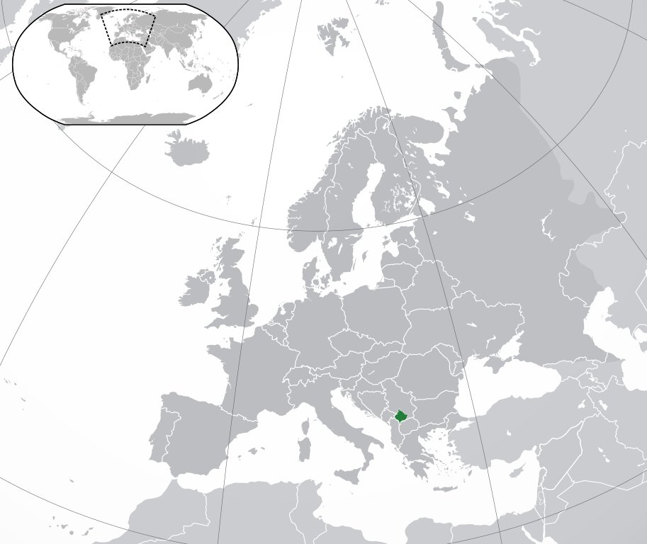
English: Republic of Kosovo, map without Serbian claim,
Is not the same as Europe-Kosovo.svg, there is Serbia marked in another grey (claim) as the other European countries
Українська: Розташування Косова на карті Європи |
||
| ວັນທີ | |||
| Source | Own work | ||
| ຜູ້ຂຽນ |
|
||
| Permission (Reusing this file) |
|
||
| SVG genesis |

Licensing
I, the copyright holder of this work, hereby publish it under the following license:
This file is licensed under the Creative Commons Attribution-Share Alike 3.0 Unported license.
- You are free:
- to share – to copy, distribute and transmit the work
- to remix – to adapt the work
- Under the following conditions:
- ສະແດງທີ່ມາ – You must give appropriate credit, provide a link to the license, and indicate if changes were made. You may do so in any reasonable manner, but not in any way that suggests the licensor endorses you or your use.
- ແບ່ງປັນຄືກັນ – If you remix, transform, or build upon the material, you must distribute your contributions under the same or compatible license as the original.
ປະຫວັດໄຟລ໌
ຄລິກທີ່ ວັນທີ/ເວລາ ເພື່ອເບິ່ງໄຟລ໌ດັ່ງທີ່ມັນປາກົດໃນເວລານັ້ນ
| ວັນເວລາ | ຮູບຍໍ່ | ມິຕິ | ຜູ້ໃຊ້ | ຄວາມເຫັນ | |
|---|---|---|---|---|---|
| ປະຈຸບັນ | 13:15, 17 ທັນວາ 2023 | | 2,045 × 1,720(7.31 MB) | Iktsokh | Cyprus geographically in Asia |
| 19:04, 26 ຕຸລາ 2016 |  | 2,045 × 1,720(7.31 MB) | Giorgi Balakhadze | Rv of sockpuppet and per COM:OVERWRITE | |
| 01:08, 16 ພະຈິກ 2014 |  | 2,045 × 1,720(7.39 MB) | Leftcry | Reverted to version as of 11:16, 9 September 2014 a map that shows the shadow already exists, you also messed up the visual | |
| 15:33, 25 ຕຸລາ 2014 |  | 1,336 × 1,170(227 KB) | VS6507 | disputed territory indication shadow | |
| 15:25, 25 ຕຸລາ 2014 |  | 2,570 × 2,250(2 KB) | VS6507 | disputed territory shadow | |
| 11:16, 9 ກັນຍາ 2014 |  | 2,045 × 1,720(7.39 MB) | Rob984 | General improvements | |
| 23:20, 2 ກໍລະກົດ 2013 |  | 2,045 × 1,720(2.7 MB) | Klodde | User created page with UploadWizard |
ການໃຊ້ໄຟລ໌
ໜ້າຕໍ່ໄປນີ້ເຊື່ອມໂຍງຫາໄຟລ໌ນີ້:
ການໃຊ້ໄຟລ໌ທົ່ວໂລກ
ວິກິອື່ນ ໆ ຕໍ່ໄປນີ້ໃຊ້ໄຟລ໌ນີ້:
- ການໃຊ້ງານເທິງ af.wikipedia.org
- ການໃຊ້ງານເທິງ als.wikipedia.org
- ການໃຊ້ງານເທິງ ami.wikipedia.org
- ການໃຊ້ງານເທິງ am.wikipedia.org
- ການໃຊ້ງານເທິງ an.wikipedia.org
- ການໃຊ້ງານເທິງ ar.wikipedia.org
- ການໃຊ້ງານເທິງ arz.wikipedia.org
- ການໃຊ້ງານເທິງ ast.wikipedia.org
- ການໃຊ້ງານເທິງ avk.wikipedia.org
- ການໃຊ້ງານເທິງ ay.wikipedia.org
- ການໃຊ້ງານເທິງ azb.wikipedia.org
- ການໃຊ້ງານເທິງ az.wikipedia.org
- ການໃຊ້ງານເທິງ az.wiktionary.org
- ການໃຊ້ງານເທິງ ban.wikipedia.org
- ການໃຊ້ງານເທິງ ba.wikipedia.org
- ການໃຊ້ງານເທິງ be-tarask.wikipedia.org
- ການໃຊ້ງານເທິງ bg.wikipedia.org
- ການໃຊ້ງານເທິງ bh.wikipedia.org
- ການໃຊ້ງານເທິງ bo.wikipedia.org
- ການໃຊ້ງານເທິງ br.wikipedia.org
- ການໃຊ້ງານເທິງ bs.wikipedia.org
- ການໃຊ້ງານເທິງ bxr.wikipedia.org
- ການໃຊ້ງານເທິງ ca.wikipedia.org
- ການໃຊ້ງານເທິງ cdo.wikipedia.org
- ການໃຊ້ງານເທິງ ce.wikipedia.org
- ການໃຊ້ງານເທິງ chr.wikipedia.org
- ການໃຊ້ງານເທິງ ckb.wikipedia.org
- ການໃຊ້ງານເທິງ csb.wikipedia.org
- ການໃຊ້ງານເທິງ cs.wikipedia.org
- ການໃຊ້ງານເທິງ cy.wikipedia.org
- ການໃຊ້ງານເທິງ de.wiktionary.org
- ການໃຊ້ງານເທິງ diq.wikipedia.org
- ການໃຊ້ງານເທິງ el.wikipedia.org
- ການໃຊ້ງານເທິງ en.wikipedia.org
- ການໃຊ້ງານເທິງ en.wikibooks.org
- ການໃຊ້ງານເທິງ en.wikivoyage.org
View more global usage of this file.