ຮູບ:Bangkok satellite city-area.jpg
ຂະໜາດຂອງຕົວຢ່າງນີ້: 800 × 599 ພິກເຊວ ຄວາມລະອຽດອື່ນ ໆ: 320 × 240 ພິກເຊວ | 640 × 479 ພິກເຊວ | 1,024 × 766 ພິກເຊວ | 1,280 × 958 ພິກເຊວ
ໄຟລ໌ຕົ້ນສະບັບ (1,280 × 958 ປິກເຊລ, ຂະໜາດໄຟລ໌: 828 KB, MIME type: image/jpeg)
ສະຫຼຸບ
| ລາຍລະອຽດ |
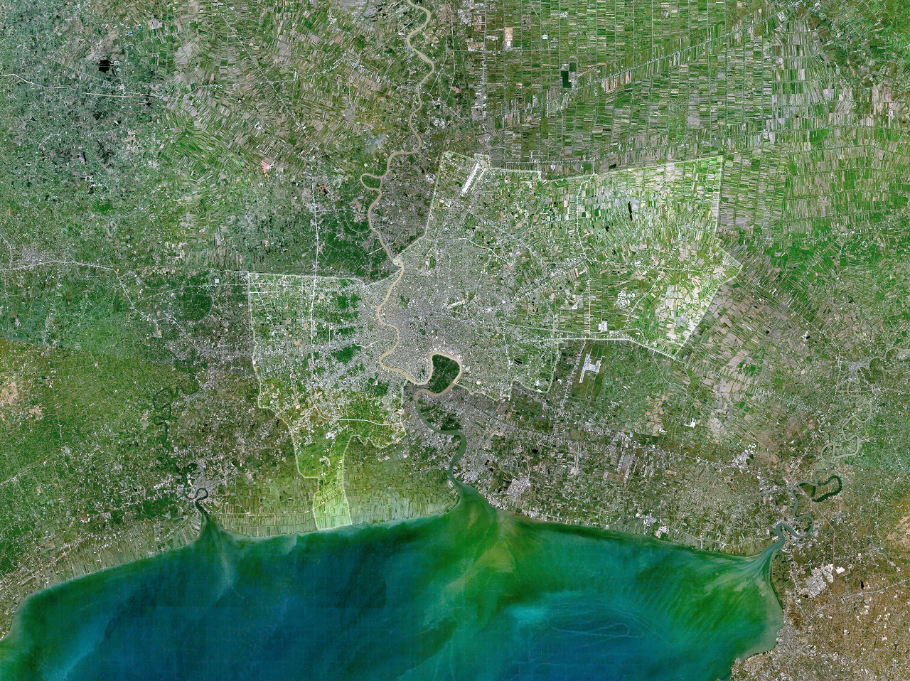
Satellite image of Bangkok; the area of the city is highlighted and bordered.
|
| ວັນທີ | ໑໒ ກຸມພາ ໒໐໐໖ (original upload date) |
| Source | No machine-readable source provided. Own work assumed (based on copyright claims). |
| ຜູ້ຂຽນ | No machine-readable author provided. Tsui assumed (based on copyright claims). |
Licensing
| I, the copyright holder of this work, release this work into the public domain. This applies worldwide. In some countries this may not be legally possible; if so: I grant anyone the right to use this work for any purpose, without any conditions, unless such conditions are required by law. |
ປະຫວັດໄຟລ໌
ຄລິກທີ່ ວັນທີ/ເວລາ ເພື່ອເບິ່ງໄຟລ໌ດັ່ງທີ່ມັນປາກົດໃນເວລານັ້ນ
| ວັນເວລາ | ຮູບຍໍ່ | ມິຕິ | ຜູ້ໃຊ້ | ຄວາມເຫັນ | |
|---|---|---|---|---|---|
| ປະຈຸບັນ | 18:06, 12 ກຸມພາ 2006 | | 1,280 × 958(828 KB) | Tsui | Satellite image of '''Bangkok'''; the area of the city is highlighted and bordered. ---- *creator: ~~~~ *based on: Image:Bangkok 100.58216E 13.71989N.png |
ການໃຊ້ໄຟລ໌
ໜ້າຕໍ່ໄປນີ້ເຊື່ອມໂຍງຫາໄຟລ໌ນີ້:
ການໃຊ້ໄຟລ໌ທົ່ວໂລກ
ວິກິອື່ນ ໆ ຕໍ່ໄປນີ້ໃຊ້ໄຟລ໌ນີ້:
- ການໃຊ້ງານເທິງ ba.wikipedia.org
- ການໃຊ້ງານເທິງ bn.wikipedia.org
- ການໃຊ້ງານເທິງ bs.wikipedia.org
- ການໃຊ້ງານເທິງ ca.wikipedia.org
- ການໃຊ້ງານເທິງ de.wikipedia.org
- ການໃຊ້ງານເທິງ en.wikipedia.org
- ການໃຊ້ງານເທິງ eo.wikipedia.org
- ການໃຊ້ງານເທິງ gl.wikipedia.org
- ການໃຊ້ງານເທິງ hu.wikipedia.org
- ການໃຊ້ງານເທິງ ja.wikipedia.org
- ການໃຊ້ງານເທິງ myv.wikipedia.org
- ການໃຊ້ງານເທິງ nds.wikipedia.org
- ການໃຊ້ງານເທິງ nl.wikipedia.org
- ການໃຊ້ງານເທິງ nn.wikipedia.org
- ການໃຊ້ງານເທິງ pl.wiktionary.org
- ການໃຊ້ງານເທິງ sat.wikipedia.org
- ການໃຊ້ງານເທິງ sh.wikipedia.org
- ການໃຊ້ງານເທິງ sk.wikipedia.org
- ການໃຊ້ງານເທິງ sr.wikipedia.org
- ການໃຊ້ງານເທິງ th.wikipedia.org
- ການໃຊ້ງານເທິງ ur.wikipedia.org
- ການໃຊ້ງານເທິງ vi.wikipedia.org
- ການໃຊ້ງານເທິງ www.wikidata.org
- ການໃຊ້ງານເທິງ zh-yue.wikipedia.org
- ການໃຊ້ງານເທິງ zh.wikipedia.org